Web-Based GIS for All

Summary
Landpoint's customers needed a way for all their users with varying levels of GIS knowledge to access their own GIS data.
My Part
Lead GIS Analyst
Skills Learned + Demonstrated
UX Design
ArcSDE geodatabase creation
QC procedure generation
Digitization and implementation of paper and digital drafting files
Interfacing professionally with the customer to gain insight on what's needed
The Proposal
Landpoint specializes in land surveying and GIS data management for multiple companies in oil and gas. Marathon Oil Corporation and Conoco Phillips were two oil and gas companies that needed a way for all of their employees (as well as 3rd parties) to access their GIS data securely and easily, without knowing much about GIS as a discipline. The GIS needed to cater to individuals ranging from GIS professionals, drafters, and surveyors in the field, all the way to record keepers, legal teams, and potential customers for Marathon and Conoco.
Additionally, data were coming from not only Landpoint's own surveyors and drafters, but several other 3rd party land surveying teams as well. All the data needed to funnel into one large geodatabase seamlessly and quickly, as there would be large amounts of data coming in at once and little time to tweak all of it to fit our GIS.
What I Did
I started by inputting the barebones shapefile (roads, easements, oil and gas pipelines, etc.) into a server-based geodatabase through ArcSDE. ArcSDE enables the user to "check out" a shapefile, make changes, and then apply those changes to the shapefile on the server, all without taking the server offline. This was important because users could be trying to access the GIS at all hours of the day. Not only does ArcSDE allow for dynamic changes to shapefile without interrupting service, but it also negates the worry of file redundancy due to multiple users working on the same shapefile. ArcSDE will simply merge the edits together.
The second component to this project was creating a standard workflow for all the 3rd party surveyors to adhere to. I created a standard shapefile template for each type of shapefile (not just points, polygons, and lines, but also the various assets those geometries could represent) that the other teams, as well as I, could input our data into. This allowed me to join the incoming data in the form of a shapefile to my existing shapefiles that were already on the server. The workflow proved to be invaluable when countless shapefiles began coming in from several sources and needed to be live in the GIS within a matter of hours.
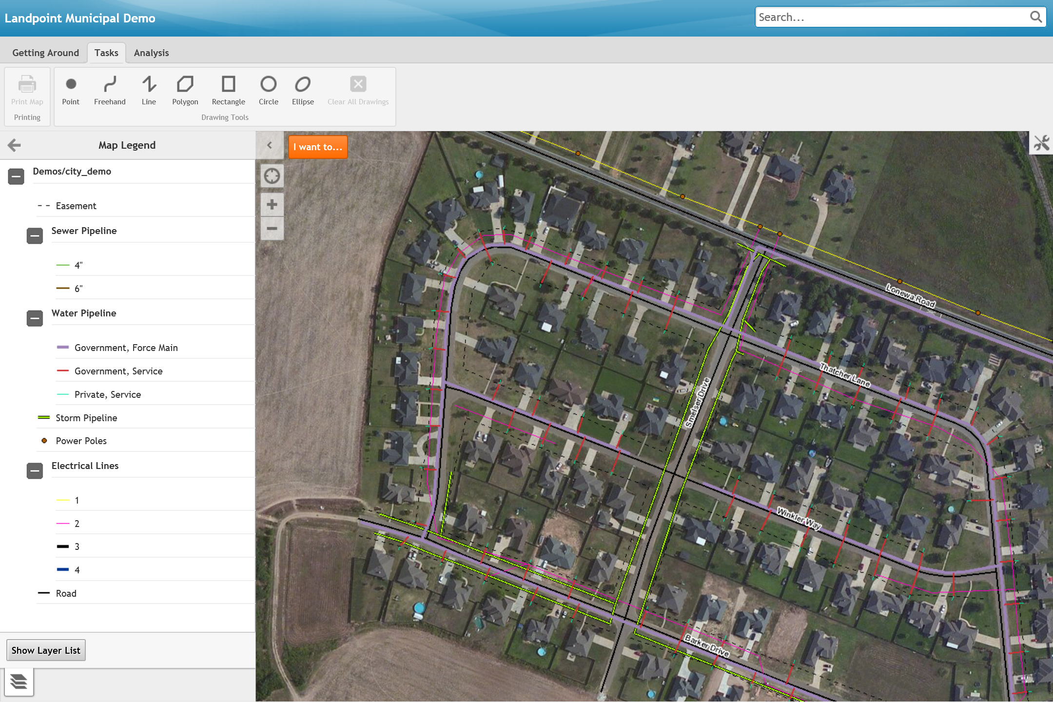
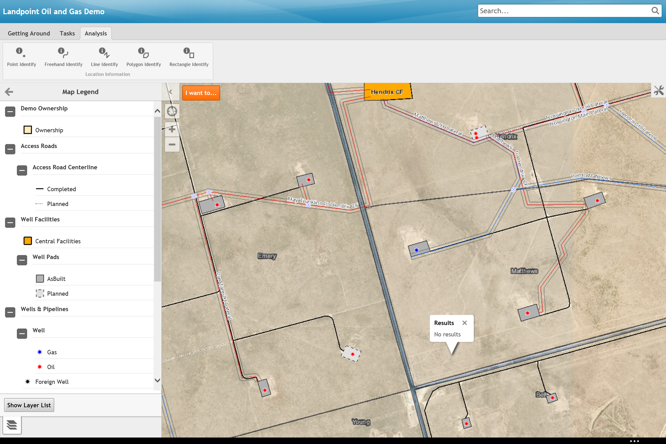
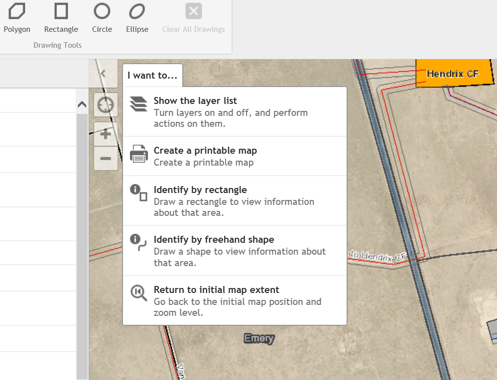
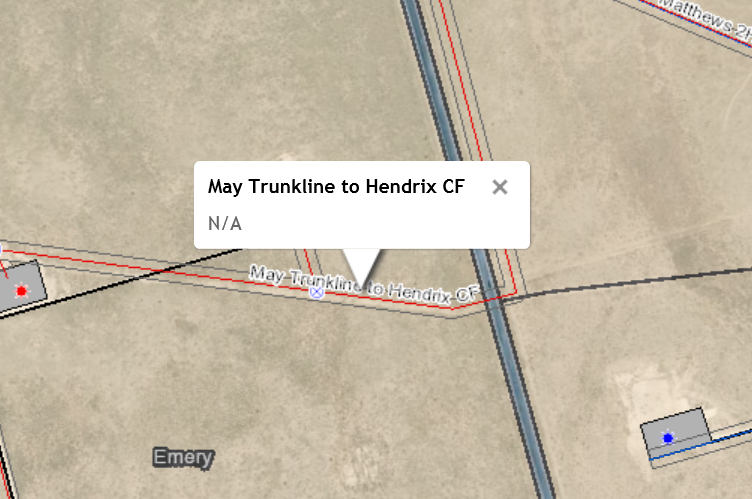
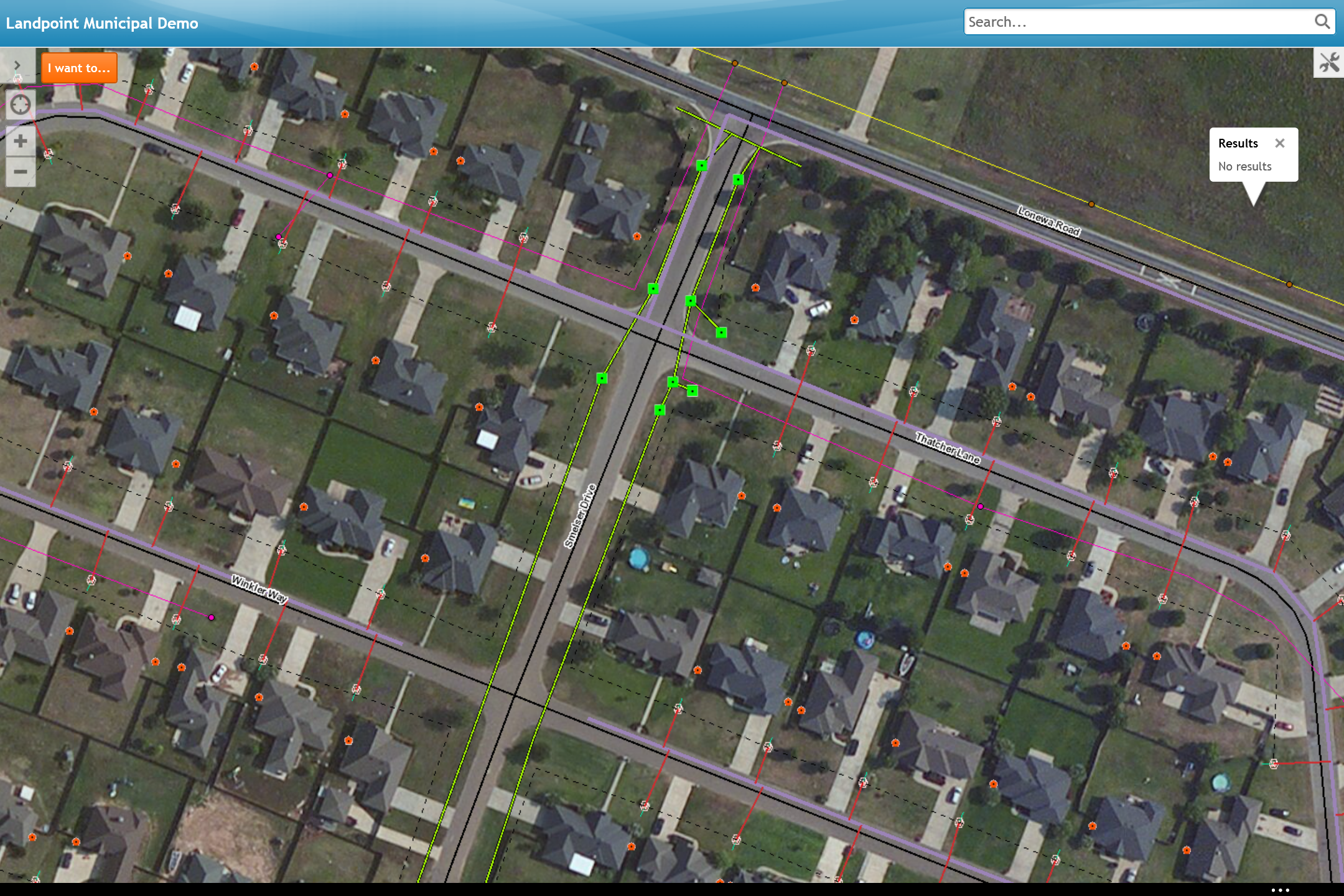
Lastly, the GIS needed to be accessible and it needed to be capable of some level of analysis. I used a tool that overlays on top of the ArcSDE-based GIS called Geocortex to accomplish this. Based on the needs on the company, I was able to add tools such as layer control, buffering, point identify, PDF creation, as well as others using Geocortex. The user could even import a shapefile stored locally on their machine to see how it would look in the GIS without affecting the ArcSDE based data. If a customer didn't have a need for a tool, it was stripped away, allowing for a cleaner interface.
The Result
The procedures and GIS server infrastructure were expanded to include other projects that were taken on by Landpoint because of the success of the initial geodatabases and procedures. The custom GIS interface approach is now a key marketing tool for the company.
Below is a sample of the GIS using mock data to protect the assets of the mentioned companies.